
Last updated: October 24, 2026
Quick Answer: a ranch fence can be 2 feet off line and still cause a dispute, so How to Plan a Ranch Fence for Property Lines, Easements, and Setbacks starts with the survey plat, recorded easements, and local setback rules before any post hole is dug.
A property line fencing plan for How to Plan a Ranch Fence for Property Lines, Easements, and Setbacks starts with the survey plat, not the fence post. If the line is wrong, every other choice—corners, gates, braces, even which side gets the smooth wire—gets harder and more expensive to fix later.
Start with the survey plat, not the wire spool
A ranch fence belongs on paper before it goes on the ground. The survey plat tells you where the legal boundaries are, where existing corners sit, and whether the line follows a straight course, a jog, or an older monument that is no longer obvious in the field. If you do not have a plat, the first task is to get one from your closing documents, county records, or the surveyor who marked the tract. A fence built 2 feet off line can still create a dispute if it runs the wrong side of a marker or cuts across someone else’s access.
This is the point where many generic fence articles go wrong: they jump straight to materials and skip the land records. That is backward. A post layout can be changed in an afternoon; a boundary mistake can take a survey, a re-fence, and a hard conversation.
Use the plat together with what is on the ground. Look for property markers, survey stakes, old pipe, rebar caps, concrete monuments, or witness marks the surveyor left behind. If a marker is missing or uncertain, do not guess from a tree line, a ditch, or an old fence. Those features often drift away from the legal line over time.
For this stage, a clipboard, a copy of the plat, flagging tape, and a tape measure are enough. Mark the corners you can confirm, then sketch the route in plain language: north line, east line, back pasture line, creek crossing, gate opening. That sketch becomes the working map for every later decision.
If the fence follows a shared boundary, note whether the neighbor already uses the line for livestock, irrigation, or access. A shared boundary needs more discussion than a line fully inside one tract. The goal here is not to settle every issue yet. The goal is to know exactly what legal line the fence is meant to respect.
How do easements change the fence route in How to Plan a Ranch Fence for Property Lines, Easements, and Setbacks?

An easement can override the route you first want to build. An easement gives someone else a right to use part of the land for a specific purpose, and that right can limit where a fence may go, how high it may be, and whether a gate must remain accessible.
This is one of the biggest planning mistakes on ranch property: treating every open strip as buildable. Utility corridors, access drives, drainage easements, pipeline corridors, and shared ingress routes can all sit inside the parcel while still carrying restrictions. A fence across one of those strips can block utility access or violate the recorded terms of the easement.
Read the easement language, not just the plat sketch. The document may say the holder has access “at all times,” or it may reserve a certain width—often shown in feet—or prohibit permanent obstructions. If the document is unclear, consult a title company, surveyor, or real estate attorney before the fence line is set. That is especially true where a utility line crosses near the boundary. A fence that looks harmless can become a problem if it traps crews behind locked gates or blocks a repair vehicle.
Plan the fence around the easement instead of through it. In many cases that means one of three choices: leave the corridor open, offset the fence outside the easement boundary, or include a gate that gives lawful access. A gate does not solve every issue; some easements do not allow the holder to wait on you to open it.
A practical rule is to consult a professional if the easement line is not fully clear from the plat and the recorded document. A 10-foot or 20-foot corridor may seem wide enough to ignore, but legal width is not the same as visual width. Leave room for maintenance vehicles, temporary excavation, and future upgrades. That is cheaper than relocating a line after the fact.
For ranch fence planning, easements are the place where the fence route stops being a carpentry question and becomes a title question. The smart move is to solve that on paper first.
Where setbacks and permit rules can move the line
Setbacks can push a fence several feet off the property line, even when the boundary itself is clear. A setback is a required distance from a line, road, drainage feature, building, or right-of-way, and it can come from a county rule, subdivision restriction, floodplain rule, or road authority requirement.
A generic fence plan often assumes the legal boundary is the build line. That is not always true. A ranch fence near a county road, public right-of-way, culvert, drainage swale, or county ditch may need a setback or a permit before installation starts. In some places the permit is for the fence itself; in others the permit is really about visibility, access, drainage, or utility clearance.
Check the local fence permit rules before you buy posts. That matters because a 6-foot fence that fits the land can still be rejected if it sits too close to the road edge or within a required offset. Some local rules also distinguish between front yard, side yard, agricultural, and commercial boundaries. Ranch land is not exempt just because it is rural.
The same caution applies where a setback affects a gate. A gate placed too close to a road or intersection can create a sightline problem, and a gate inside a drainage setback can interfere with water flow. If there is a public road ditch, a county culvert, or a flood-prone wash, the fence route may need to step back or bridge the area in a permitted way.
Do not assume the setback is measured from the visible pavement edge. The measurement may start from the right-of-way line, centerline, ditch line, or recorded easement boundary. That difference can be several feet and changes the whole layout.
The best practice is to match the survey plat, the county fence permit rules, and the recorded easements before any corner is staked. If those three sources disagree, pause. A fence that is legal on the survey but illegal under local setback rules still has to move.
A practical fence-route procedure for property line planning
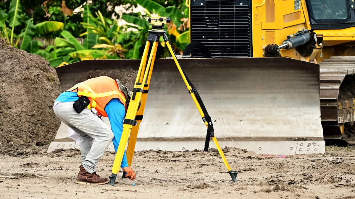
A property line fencing plan works best when it follows a short, disciplined route-selection process. Use the steps below before anyone digs a post hole.
- Lay the plat over the actual land. Mark each corner on the ground from the survey plat, then walk the line and note where the fence would cross brush, washes, gates, or old fence remnants. The result is a route that matches legal boundary points instead of guesswork.
- Flag every uncertain point with survey stakes or tape. Put visible flags at corners, bends, easement edges, and setback limits so the route can be checked from a distance. The result is a field map that a fence crew can follow without re-reading the plat every 20 feet.
- Measure utility crossings and access strips separately. Treat each utility line, driveway, and corridor as a separate design problem, even if it sits near the same boundary. When the route crosses a service area, consult the relevant utility or land professional as needed; the result is fewer surprises when the route approaches a buried line or a service path.
- Decide where gates belong before setting the fence line. Place gates where livestock movement, vehicle access, and easement access all make sense, not where the fence happens to be easiest to build. The result is a route that supports daily use instead of fighting it.
- Check the fence permit and setback rules against the marked route. Compare the intended line with local requirements for roads, drainage, and public access. The result is a layout that can be approved without having to shift the line later.
- Confirm shared boundaries with the neighbor in writing. If the fence sits on or near a shared line, document who is building, where the line falls, and whether the fence is intended as a boundary fence or an interior livestock fence. The result is less room for a future dispute about ownership or maintenance.
This procedure is deliberately slower than just staking the obvious line, but it prevents the most expensive mistake: building a fence that has to be moved after the posts are set. A 1-day delay before construction is usually cheaper than a 1-week correction after materials are in the ground.
One more useful habit: keep a marked copy of the final route with the plat, the permit, and the easement documents. When a gate is repaired or a corner is rebuilt later, that paper trail matters more than memory.
Shared boundaries need a paper trail, not a handshake
A shared boundary needs written agreement, or at least written proof of what both sides understood. A handshake can be enough for a neighborly conversation, but it is weak protection if the fence later becomes a boundary dispute.
This is where ranch fence planning gets tense, because the fence may serve both property control and neighbor relations. If the fence is exactly on the line, ownership of the fence, responsibility for repair, and the location of the legal boundary all need to be clear. If the fence is set inside one tract, it is no longer a true boundary fence, and that distinction should be written down.
A common mistake is letting an existing old fence define the line without checking the survey plat. Old woven wire, weathered T-posts, or a crooked barbed-wire run may have been built decades ago for convenience, not legality. If that fence has drifted, it can create a long-term occupation problem or a false expectation about where the line runs.
Use a simple written note if the relationship is cooperative: date, parcel names, fence location, who will build it, who pays, where gates sit, and whether either party may attach livestock panels or temporary wire later. A more formal agreement is better when the line is active, disputed, or near development pressure. The format matters less than the clarity.
Also consider maintenance access. A fence on a shared line can still leave one owner stranded if the posts are placed flush against a tree line, ditch bank, or wash. Leave room to paint, brace, and repair from both sides if the agreement allows it. If one side must be accessible only by crossing another tract, put that in writing too.
This is the part of planning that most “how to build a fence” guides skip. They treat the fence as an object. On a ranch, the fence is also a legal boundary marker, a daily-use structure, and sometimes a future piece of evidence. That means the paper trail matters as much as the wire.
Utility lines and access routes come before post holes
Utility lines and access routes have to be protected before the first corner post is set. Buried electric, water, gas, telecom, and irrigation lines can sit near a boundary even when nothing visible shows on the surface, and the fence route has to respect them.
Do not dig on the assumption that a line “probably” is not there. Use the utility locate process required in your area and wait for the marks before excavation. A fence built over a buried line can complicate repair access and can turn a simple maintenance job into a damaged-post or damaged-line problem. A route that crosses a utility easement should be considered a design conflict, not a minor nuisance.
Access matters just as much. If a utility company, irrigation district, county crew, or neighbor needs periodic access to a line, a locked gate or solid barrier can create a recurring dispute. A fence that makes access awkward is usually the wrong fence route, even if it sits neatly on the property line.
Think about where trucks turn, where a backhoe fits, and where a crew can stage work without cutting the fence apart. That means leaving practical width at key points and avoiding tight doglegs near service corridors. In ranch country, access is often more valuable than perfect straightness.
One useful check is to stand at the intended gate location and imagine a service truck arriving at 6 a.m. after a storm. If the route requires moving cattle, unhooking wire, or climbing a bank to reach the line, it is probably not the right place. Good fence planning leaves the maintenance path as clear as the livestock path.
That same logic applies to irrigation and drainage hardware. A fence that blocks a valve, siphon, or culvert lid will create repeated problems. Better to adjust 6 to 12 feet on paper than fight the same obstruction for years.
What most ranch fence plans get wrong
Most ranch fence plans fail by treating the legal line as the only line that matters. The boundary is only one layer. Easements, setbacks, utility corridors, and shared-use access can all change where the fence should actually go.
The second mistake is assuming the visible field edge is the legal boundary. Old fence rows, tree lines, and ditches are not proof of the line. They are only clues. If the survey plat and the property markers do not match the old fence, the old fence loses.
A third mistake is skipping the permit check because the land is rural. A fence permit may still be needed near roads, drainage areas, or subdivision edges, and local rules can affect height, placement, or openness. Build first and ask later, and you may end up tearing out finished work.
The fourth mistake is forgetting that the fence route is also a maintenance route. A line that leaves no room for a mower, a service truck, or a utility repair is not well planned, even if it looks tidy on the map. Straight is not always smart.
The hard truth is that this subject is not for a fence built by instinct alone. If the parcel has unclear corners, multiple easements, or a disputed shared boundary, a surveyor or land-use professional is worth involving before materials are ordered. That is especially true when the fence is near a road, public utility, or recorded access route, because the cost of a wrong move is not just wasted wire. It can become a legal dispute.
For the broader planning sequence beyond the boundary work, the hub on ranch fence planning and layout covers the next step without repeating the legal route rules here.
Key takeaways
- The survey plat and property markers decide where the fence should go; old field lines do not.
- Easements can limit or redirect the route, even when the land is privately owned.
- Setbacks and fence permits can move the line off the boundary, so check local rules before staking corners.
Drafted with AI; not yet reviewed by a person.